
advanced
drone
solutions
great aerial photographs, videos, and so much more
realistic 3d models
This 3D model of Barley Creek Brewing Company in Tannersville, PA was created from combining 142 photographs overlapping each other and taken from multiple angles in drone mapping software through a process called photogrammetry. These models can then be rotated, zoomed in or out, and measured to within a half inch of accuracy for elevation, distance, area, and volume. Go ahead and touch the model to stop the automatic rotation so that you can look at whatever you want to in more detail.
large area maps
I created this 16 acre project to track the repair efforts that were done last September to the Pocono Creek in the PHLT nature preserve behind Tannersville Weis grocery store. I have the normal vision model displayed as default, but can be changed by clicking the “layers” icon in the upper right corner of the map to see the colored elevation version. There are a number of other tools that can be used in the map on the left side. The 217 mission pictures were captured on January 2nd 2023. If you would like to see the 3D output of this project please click here.
nothing beats a bird's eye view
If a picture is worth a thousand words, then twenty-five pictures taken from 350 feet overhead and then stitched together to form a 360 degree spherical panorama that can be rotated and zoomed in and out must be worth, well…
You will have to decide that for yourself.
Time lapse videos
This was a passion project that I gave a try because the house was being built around the corner from my own. I used drone flight planning software to set up a orbit that was then repeatable to fly and capture a picture every 3 seconds over a period of 18 minutes. As much as I love watching this house being built over and over again each time I watch it, I still see all the ways that I could have made the video even better. Coordination with the home builder for when to fly my orbits would have helped a lot.
FPV flight videos
This is the wild side of Bush Drone Service. I have been building and flying FPV (first person view) drones for five years now as a hobby and I absolutely love it! Real time video signal is sent to video goggles that are worn to see right out of the front of the drone. Nothing in the drone world compares with the exhilaration of the “flying by the seat of your pants” feeling that you get from flying FPV. It is like you are sitting in the cockpit of a stunt plane, no time to think about anything else except for trying to make that bird fly where you want it to. That same feeling translates very well into the video footage that is captured in the process. There are tons of ways to use this kind of video to promote all kinds of businesses. I’m a dreamer, just tell me what you do and I will find a way to capture it like no one else can.
FAA Licensed Commercial Drone Pilot
Bush Drone Service is your FAA Part 107 Certified Aerial Solution in the Poconos, Eastern Pennsylvania, and New Jersey. Based out of Tannersville, PA, we are a fully insured commercial drone piloting service and aerial data collection service ready to serve you. If you are looking for legal aerial data and imagery services then you have found the right company.
custom web pages for every project
In order to make Bush Drone Service stand out above the rest not only in the products we deliver, but also in the way your imagery deliverables are presented to you, each project will have it’s own custom web page.
Your custom web pages will be either public, private, or password protected depending on your needs. This provides you with a easy way to share tasteful presentations, viewable on both computers and smart phones alike, of your projects with clients. There will also be direct Dropbox download links for each of your files with easy to understand labels at the bottom of each project web page along with a separate copy and paste area for any embed link codes to display 3D models, mapping projects, panoramas, and 360 virtual tours on your own web sites, social media, and MSL listings.
The sky is the limit no more
Let us show you how all of the more advanced applications of drone imagery can help your business prosper.
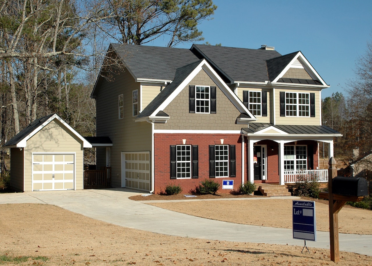
Residential Real Estate
Stand out from all of the rest in the area with a awesome 3D model of your house and property in your listing!!!
Of course we also do great traditional aerial photography, videos, and 360 spherical panoramas from the air, property grounds, and interiors to form unique 3D virtual tours as well.
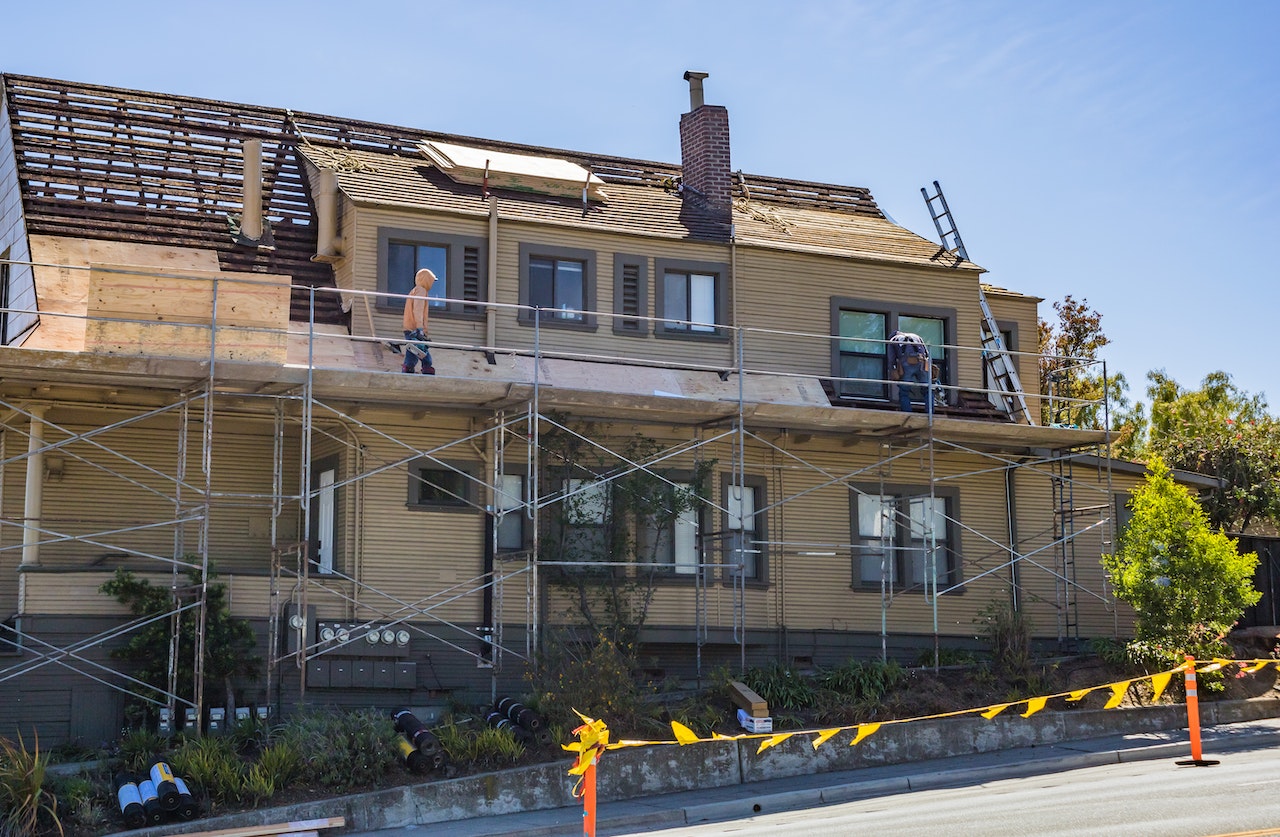
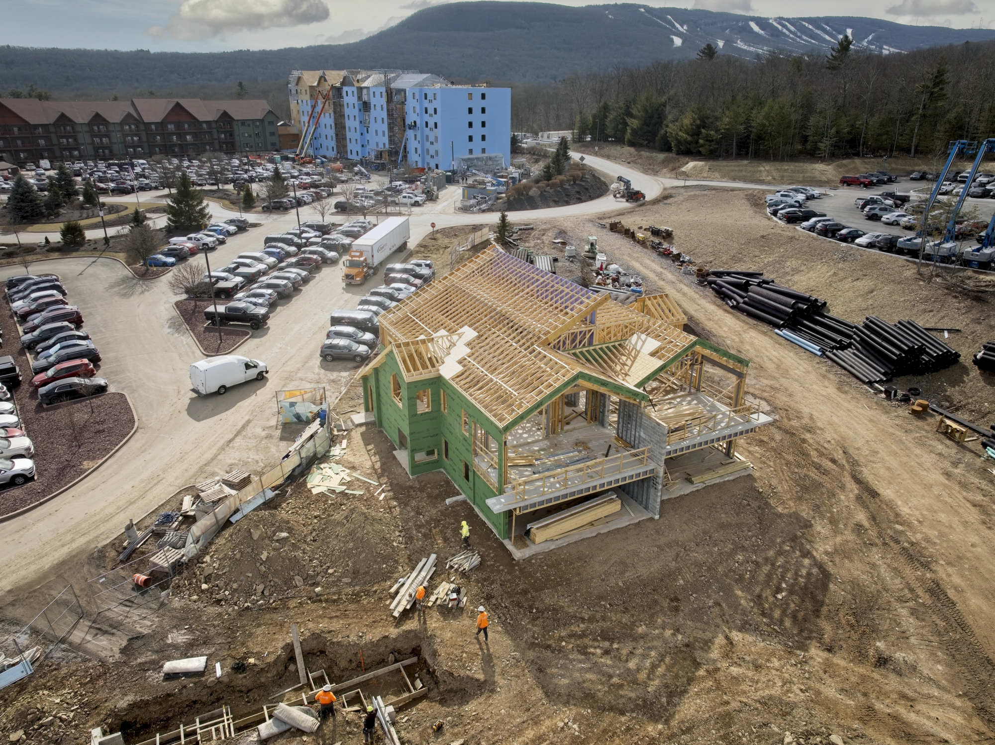
New Home Construction
Through the use of Dronelink flight mission planning software, our drones can be tasked to fly the exact same route and capture images of the same areas on daily, weekly, or monthly intervals allowing us to make some very impressive time lapse videos of your construction progress.
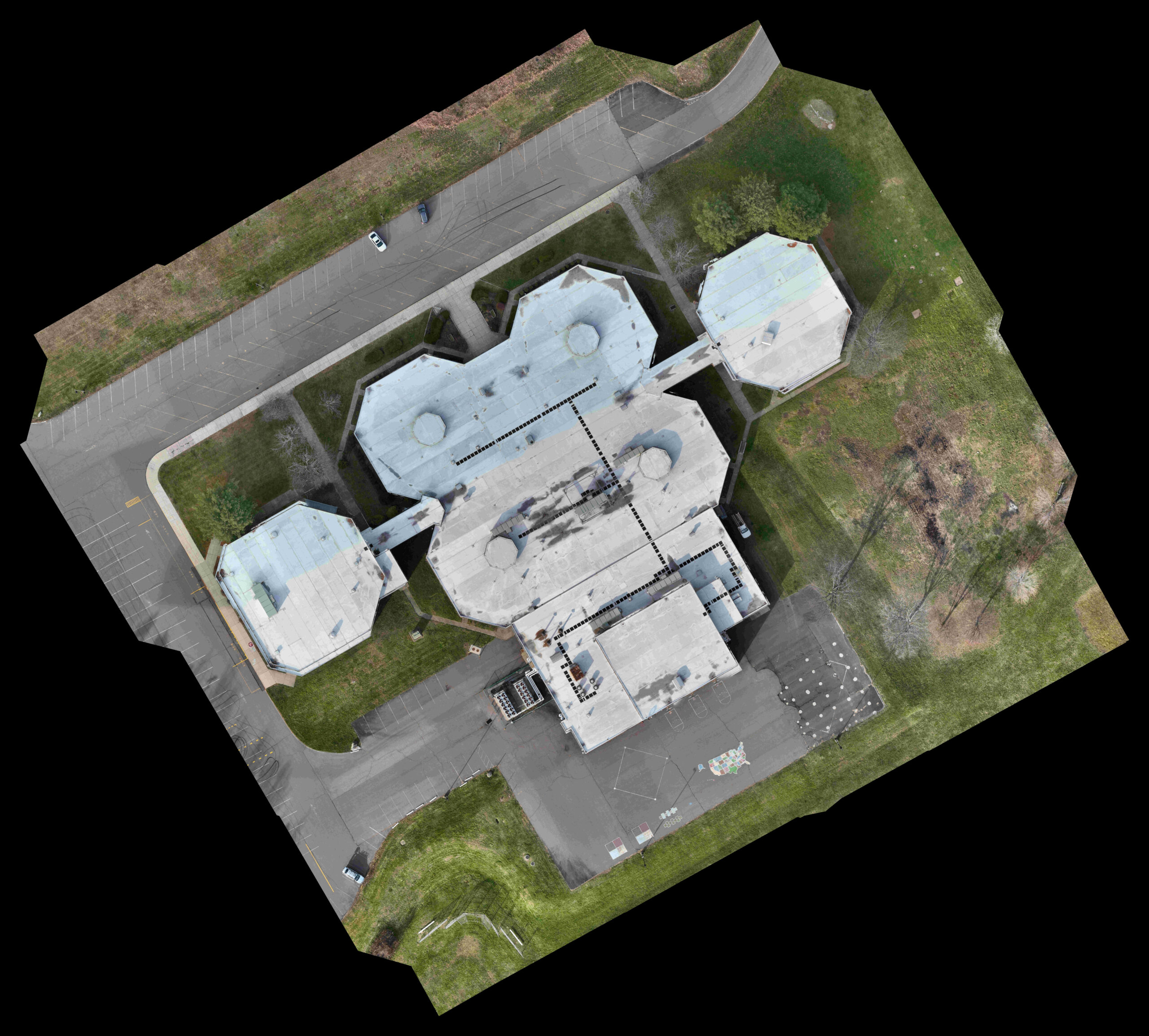
Property Management
Mapping commercial properties to produce both very realistic 3D models and top down high resolution maps on monthly or yearly basis allows property managers to see the current conditions of their sites, annotate points of interest or areas needing repair/upkeep, and provides a record of installation for after work has been completed.
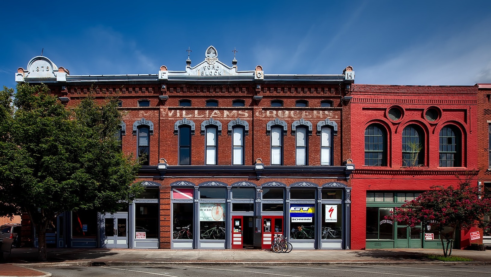
Commercial Real Estate
Imagine if you could get a Google Maps type image of your property with much better resolution and as current as the day it was taken. This is exactly what a orthomosaic is, made from many pictures stitched together and processed to show just a top down view of the area, no matter how large it is. This is a downscaled version of one I made of the Pocono Elementary School on Warner Rd.
Commercial Construction
There are many services out there to vastly improve enterprise wide construction tracking utilizing aerial and ground based imagery. I would love to explore the use of a system like DroneDeploy with construction company. Whether you would like to hire me to do every bit of your imagery captures, only the drone based data, or if you would like to implement your own drone division within your company and need someone to help train your staff, I’m here to help. Click here to see what DroneDeploy has to offer.
Insurance Claims
A 3D model that is highly detailed, measurable, and able to be viewed from any angle or zoom level is a great way to capture the current condition of a property after a accident has happened. We will also provide you with other pictures, videos, and 360 spherical panoramas from ground level and the air to document the extent of damages done as best as possible.
Talk to Us
Have any questions? We are always open to talk about your business, new projects, creative opportunities and how we can help you understand all the different ways that our drone solutions can improve your business.